Clock tower (Faisalabad)


The Faisalabad Clock Tower is a clock tower in Faisalabad, Punjab, Pakistan, and is one of the oldest monuments still standing in its original state from the period of the British Raj. It was built by the British, when they ruled much of the South Asia during the nineteenth century.

The majestic Clock Tower of Faisalabad was constructed out of the funds raised by the local Zamindars who collected it at a rate of Rs. 18 per square of land. The fund thus raised was handed over to the Municipal Committee which undertook to complete the project.

The locals refer to it as "Ghanta Ghar" in Urdu which translates into Hour House in English. It is located in the older part of the city. The clock is placed at the center of the eight markets that from a bird's-eye view look like the Union Jack flag of the United Kingdom. This special layout still exists today and can be viewed using the latest software from Google Maps.

During festivals of Eid and Independence Day the mayor (nazim) of Faisalabad delivers a speech at this site and hangs the flag at full mast.
Read more...

Nanga perbat (northern area)


The Himalayas are a great mountain range formed by the collision of Indo-Pakistan tectonic plate with the AsianNanga Parbat - Pakistan Continent.The central Himalayan mountains are situated in Nepal, while the eastern mountains extend to the borders of Bhutan and Sikkim. Nanga Parbat massif is the western corner pillar of the Himalayas. It is an isolated range of peaks just springing up from nothing, and is surrounded by the rivers Indus and Astore. Nanga Parbat or "Nanga Parvata" means the naked mountain. Its original and appropriate name, however, is Diamir the king of mountains.

Nanga Parbat (main peak) has a height of 8,126m/26,660 ft. It has three vast faces. The Rakhiot (Ra Kot) faceNanga Parbat - Pakistan is dominated by the north and south silver crags and silver plateau; the Diamir face is rocky in the beginning. It converts itself into ice fields around Nanga Parbat peak. The Rupal face is the highest precipice in the world. Reinhold Messner, a living legend in mountaineering from Italy, says that "every one who has ever stood at the foot of this face (4,500m/14,764ft) up above the 'Tap Alpe', studied it or flown over it, could not help the amazement of its sheer size; it has become known as the highest rock and ice wall in the world!". Nanga Parbat has always been associated with tragedies and tribulations until it was climbed in 1953. A lot of mountaineers have perished on Nanga Parbat since 1895. Even today it is claiming a heavy toll of human lives, mountaineers in search of adventure and thrill, and in finding new and absolutely un-climbed routes are becoming its victims.

It was in 1841 that a huge rock-slide from the Nanga Parbat dammed the Indus river. This created a huge lake,Nanga Parbat - Pakistan 55 km long,like the present Tarbela lake down-stream. The flood water that was released when the dam broke caused a rise of 80 ft in the river's 3 level at Attock and swept away an entire Sikh army. It was also in the middle of the nineteenth century that similar catastrophes were later caused by the damming of Hunza and Shyok rivers.

The Nanga Parbat peak was discovered in the nineteenth century by Europeans. The Schlagintweit brothers, who hailed from Munich (Germany) came in 1854 to Himalayas and drew a panoramic view which is the first known picture of Nanga Parbat. In 1857 one of them was murdered in Kashgar. The curse of Nanga Parbat had begun!
Read more...

Pakistan mountains


Pakistan is a land of varied and unique landscape. While high mountain ranges dominate its North, series of low mountain ranges of Suleman, Pub, Kirthar and Mekran extend from North to Southwest and to South in a bone like manner. These low ranges dominate the plains and deserts to the East and warm and captivating beaches of the Arabian Sea to the South. It is, however, Northern Pakistan which is endowed with most unique geographical feature in the world. It is here that the three great, lofty and spectacular mountain ranges, Karakoram, Hindukush and Himalayas meet. In an area of about 500 kms in width and 350 kms in depth, is found the most dense collection of some of the highest and precipitous peaks in the world, boasting more than 700 peaks above 6000 metres, and more than 160 peaks above 7000 metres.

These include five out of the total fourteen above eight thousand metre high peaks on earth, namely the second highest rock pyramid - the K-2 (8611 m), the killer mountain Nanga Parbat (8125 m), the Hidden Peak, Gasherbrum I (8068 m), the Broad Peak (8047 m) and the Gasherbrum II (8035 m). This enormous mountain wealth makes Pakistan an important mountain country, offering great opportunities for mountaineering and mountain related adventure activities. The area is aptly called a paradise for mountaineers, adventure seekers and nature lovers. The compelling charm of these high, challenging, endless sea of rugged rock and ice pinnacles lure large number of climbers, adventure seekers and nature lovers from across the five continents to the Northern Areas and Chitral, each year.
Read more...


The Motorways of Pakistan are a series of international-standard, high-speed, limited-access highways in Pakistan, which are maintained and operated by the National Highway Authority.

The first motorway in Pakistan was operationalized in November 1997 and, by April 2010, the total length of operational motorways in Pakistan was 632 km with another 233 km under construction and further planned.
Features

Pakistan's motorways are either six-lanes or four-lanes with a universal minimum speed limit of 80 km/h and maximum speed limit of 100 km/h for heavy transport vehicles and 120 km/h for light transport vehicles. They have a central median and are fenced on the outside for safety and prevention of unauthorized access by pedestrians, animals and slow-moving vehicles. Entry to all motorways in Pakistan are restricted to fast moving vehicles only. Pedestrians, bicycles, motorcycles, animal-driven carriages and other slow moving vehicles are not permitted onto the motorways. The Pakistan National Highways & Motorways Police do, however, use heavy motorbikes for patrolling purposes. By February 2010, operational motorways in Pakistan had a combined length of 632 km with another 233 km under construction and further planned. Pakistan's Motorways are part of its National Trade Corridor Project that aims to link Pakistan's three Arabian Seaports of Karachi Port, Port Bin Qasim and Gwadar Port to the rest of the country and further north with Afghanistan, Central Asia and China.
Read more...

Clifton Beach (Karachi)


Clifton Beach or Seaview is a beach in Karachi, Pakistan located on the Arabian Sea. It is one of the neighborhoods of Clifton, Saddar Town. It was the world's most popular silver-sand beach and health resort during 20th century but In 2003, it was affected by an oil spill.[1] The beach has attractions for families and tourists, including beachside horse and camel rides, amusement parks, restaurants, and swimming in the Arabian Sea.

Dolmen City an Under-Construction Shopping Mall and Commercial High-rise Complex at Clifton Beach.

A gated residential area called Seaview Apartments lies close to a section of Clifton beach known as Seaview beach or simply "Seaview". Further ahead lies Darakhshan Villas which comprises residential townhouses and huts.

Evening scene on Clifton beach.

Another attraction in this very area were the recently constructed Cineplex cinema houses for the entertainment starved people of Karachi, particularly for the people who reside in DHA and Clifton. This has happened after around three decades of cinema industry decline in Pakistan. Hollywood films are mostly screened here along with some selected Bollywood films. The cinema's are equipped with state of the art facilities and other entertainment sections.

The Defence Housing Authority is filling the beach area with sand to obtain more ground pushing the sea further back, which will change the shape and features of the beach.

Other beaches close to the city include Sandspit, Hawke's Bay, and Paradise Point - a sandstone rock promontory with a natural arch, but Clifton Beach is the most popular picnic destination in Karachi.

Read more...

The Changa Manga forest (Lahore)


 The Changa Manga is a planted forest and a wildlife center in Lahore District, Punjab, Pakistan.

Forestry

The entering route to the forest is located the with a road from the N-5 Highway near Bhai Pheru.[1] It covers an area of 4,860 hectares (12,000 acres)[2] and is one of the largest man-made forests on the planet. The planting and irrigation of it took place in the 19th century in the era of the British Raj due to the need for timber for the Indian railway network. Most trees belong to the species of Dalbergia sissoo (sheesham), Acacia nilotica (kikar) or Morus alba (mulberry).


Wildlife center

The Changa Manga forest is a hot spot concerning wildlife in Punjab. Wildlife within the borders of the plantation include a small remaining population of Nilgai, hog deer, wild boar and possibly axis deer. Jackal and Asiatic wild cat can be found in Changa Manga as well. Changa Manga also serves as a wildlife breeding center.

Changa Manga plantation is also an important place for restocking projects of Asiatic vultures in Pakistan. A Gyps Vulture Restoration Program was started in 2006 by WWF-Pakistan to conserve and breed endangered species of Gyps, especially Gyps bengalensis.

Recreation center

Parts of the forest have now been developed into a park with a rail road which gives the visitor a 25 km ride on a miniature train through the forest. There is also a lake called Lunar Lake where boating is possible. The forest park has good recreational facilities and a good quality hotel.


Read more...

Tourism of chakwal


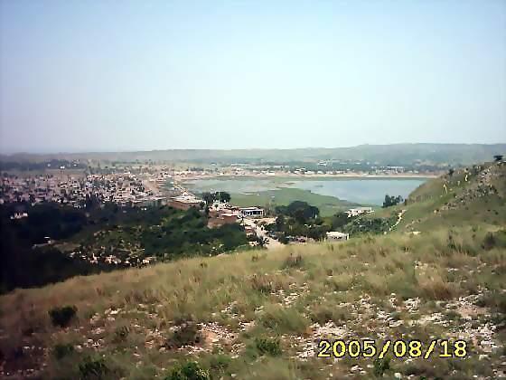
Chakwal has landscape features including the canyons in Thirchak-Mahal and the yellow beds of muster"Surson". There are many man-made and natural lakes around the city in Kallar Kahar, Dhok Talian, Kot Rajgan, Khai, Khokar Zer ,Dharabi and the most beautiful village with all the modern facilities is called KHAJULA.

The Jhangar valley, Bisharat is situated on the road coming from Choa Saidan Shah facing West to East about 8 km in length between the villages of Kotli and Ara at 3,000 feet (910 m) above sea level. The weather during the summer is very pleasant and the hills are full of green bushes and olive trees[citation needed]. An interesting place of this valley is the Picnic Point of Chehl Abdal”[citation needed] hill top which is at 3,500 feet (1,100 m) above sea level. On the top of this hill is a shrine called Chehl-Abdal. Many people from local villages and from all parts of the country often visit the shrine and offer sacrifices. From the Chehl Abdal hill top one can see the great Punjab plains. To the north are the Margla hills and to the south one can see the Jhelum River. On the East & West side one can see the beautiful greenery of adjoining hills with rain forests consisting of thick jungle trees and bushes. Alexander the Great passed through this area (old Nandana Fort) near Ara on his way to fight Raja Porus on the banks of the Jhelum River in 326 BC.

Another well-known tourist place in the area is Kalar Kahar for which Zahir uddin Baber said “Kaller Kahar is a child of Kashmir[citation needed]. Kalar Kahar is 2,500 feet (760 m) above sea level and Chehl Abdal is 3,500 feet (1,100 m) above sea level.

Larri pathan is another beautiful place in Chakwal. One faction of the Kakka Zai Pathans migrated from Afghanistan and settled in a village called Lari Pathan[citation needed].

The famous temple-fort of Katas Raj is nearby also Chakwal has a well connected road network including a road to Jhelum and Lahore via the Sohawa road, a road to Pind Dadan Khan via the Choa Siaden Shah road, a road to Sargodha via Bhon and Khushab, a road to Rawalpindi via Mandra and to Mianwali via the Talagang Road.

It is connected to the GT road between Peshawar and Lahore via Sohawa and Mandra, the Indus Highway via Mianwali, and M2 Motorway via Kallar Kahar and Balkassar exits. The travelling distances and time has reduced considerably to Lahore, Rawalpindi, Sargodha, and Faislabad since the commissioning of the M2 Motorway
Read more...